

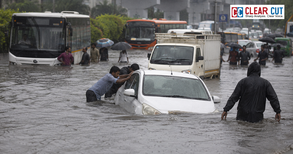
- Delhi-NCR’s recent floods highlight the consequences of outdated drainage systems, disappearing water bodies, and unplanned urban development rather than just heavy rainfall.
- The article argues that long-term, integrated urban planning—like Noida’s infrastructure-first model and global examples from China, Rotterdam, and Tokyo—is essential to build climate-resilient cities and reduce future flood risks.
By 9 July 2026, Gurugram had 115mm of rain in just 33 hours. The water, knee-deep in some parts of Golf Course Road, stranded commuters for hours; the city drowned in its filled spaces. Barely days before this, Noida Sector 115, the Malkapur roundabout of Greater Noida, was submerged in a knee-deep deluge as at least one person was killed in a rain-induced building collapse in Rohini. These incidents have been so routine that they have now moved beyond ‘accident’ for policy analysts into the realm of “consequences” – or the outcome – of the very way our cities have been built.
A Crisis Engineered by Neglect
Delhi’s drainage network still traces back to a master plan created in 1976, well before the city’s built-up area had expanded exponentially, a revised master plan for which was formally launched in September 2025. The story is even more pronounced in Gurugram: a study conducted by the Gurugram administration and presented before the National Green Tribunal found that, of the 640 water bodies in Gurugram as in 1956, 389 have been wiped out, and a Ghata Lake is estimated to have shrunk from 370 to 2 acres. “Gurugram’s utterly developer-led growth pattern further aggravates the problem”, Nidhi Batra, urban planner and founder of Sehreeti Development Practices, told Question of Cities and noted how Gurugram has malls and hotels built over natural water channels. There is an in-built counterpoint within the region.
Noida, under a single authority that plans roads, sewers, and drains well in advance of physical construction, did not experience much disruption from the same July 2026 showers as Delhi and Gurugram. According to Atul Gupta of the UP Architects and Town Planners’ Association’s Noida zone, “They first plan the infrastructure (and predict requirements for 100 years or more) and only then allot lands to builders. It is the reverse of Gurugram, where the builder decides first.”
Who’s Paying for the Water?
These are not just neutral data points. One 2021 study looking at flood-risk modeling, in Water Resources Research, showed how alleviating risk for the world’s over a billion informal settlements – the habitat of a significant portion of humanity according to WHO and UN-Habitat – is the key to interrupting the feedback loop of flood exposure entrenching poverty. Informal settlements are usually built in the lowest-lying, most exposed ground and have the weakest drainage infrastructure. We saw this ironic dissonance in Delhi in 2023, where the municipal corporation, in the very week the Yamuna overflowed its banks, bulldozed about 350 slum dwellings near its bank at Metro Vihar.
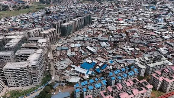
Across the country, the World Bank estimates that India’s average annual flood losses are around $4 billion – a figure predicted to shoot up to $30 billion by 2070 – even as its cities already account for over 65 percent of its GDP and more than 70 percent of its urban areas do not possess a scientifically planned stormwater system.
Beyond India: Three Ways to Rethink a Flooded City
Around the world, similar cities have treated drainage as a multi-decade infrastructure project rather than a monsoonal band-aid. China’s Sponge City program, inaugurated in 2013 following decades of recurrent urban flood disasters such as the one in Zhengzhou, which saw over 290 lives lost in 2021, is designed to use wetlands, pervious surfaces and rain gardens to absorb rather than discharge runoff, a strategy supported by about $1 trillion worth of investment required to make 80 percent of Chinese cities “spongy” by 2030. Rotterdam followed a design-led path, its Waterplein Benthemplein public square doubling as a stormwater reservoir during downpours and part of a larger effort to make the Dutch port city climate-proof by 2025.
Tokyo pursued an engineering approach: its $2.6bn Metropolitan Area Outer Underground Discharge Channel, a system of tunnels and reservoirs dug 50 meters into the ground, can divert up to 200 cubic meters of water per second and has slashed flood damage in its drainage basin by 90% since 2006.
All these strategies, whether based on nature, design, or brute engineering, involve long-term investment under a single responsible entity, the one missing variable between Noida’s limited inundations and Gurugram’s drowned tech parks. Delhi-NCR’s new drainage master plan will come under severe trial the next time the skies open up, a prospect that, based on the last two weeks alone, isn’t far off.
Clear Cut Climate Desk
New Delhi, UPDATED: July 11, 2026 17:30 IST
Written By: Yatharth Pathak