
The master plan now links 58 ministries and all 36 States and UTs on one digital platform. Its next test is whether planning data translates into fairer access for small traders, remote communities and the people whose land projects need.
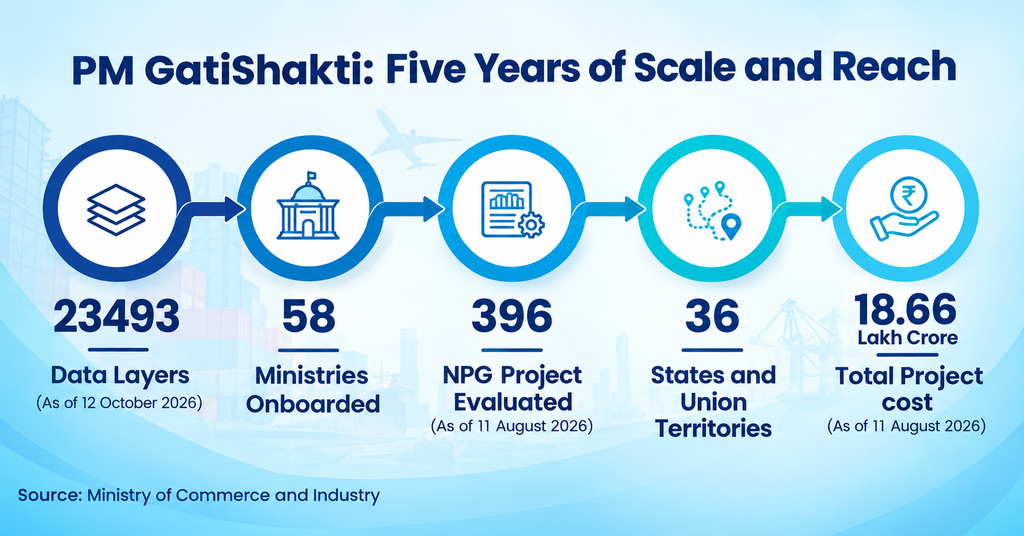
Five years after its launch on 13 October 2021, the PM GatiShakti National Master Plan covers 58 Central Ministries and Departments and all 36 States and Union Territories, with over 23,493 data layers on one GIS platform, according to a PIB backgrounder issued on 12 October 2026. By 11 August, its Network Planning Group had evaluated 396 projects worth about ₹18.66 lakh crore; 256 were sanctioned, and 198 were under implementation.
The coordination argument is that roads, railways, ports and transmission lines are mapped together, thus deterring agencies from planning alone. It is also argued that the approach allows planners to diagnose connectivity shortfalls and consider social nodes as well as economic ones.
Where access is improving
According to the release, the government will improve road connectivity by constructing a 4-lane bridge over the Brahmaputra in Assam, from Dhubri to Phulbari, reducing the distance from 205 km to 20 km and travel time from 7 hours to 30 minutes. In Bihar, the improvement of the Khagaria-Purnea corridor will connect five economic nodes – one textile park, two mega food parks, and two fishing parks with 11 logistics nodes.
The platform is also used for social infrastructure. Officials said in October 2024, as reported by The Tribune, that 45 lakh members of Particularly Vulnerable Tribal Groups and 11 lakh households had been mapped across 29,000 habitations, and that more than 10 lakh anganwadi centres were on the platform to help focus on those with greater nutritional needs.
The cost questions
Logistics is where small enterprises feel the weight of poor planning. A joint NCAER–DPIIT study put India’s logistics cost at 7.97 percent of GDP in 2023–24, or ₹24.01 lakh crore, well below the long-quoted 13–14 per cent figure. Infrastructure expert Vinayak Chatterjee, founder of the Infravision Foundation, writes in Business Standard that this places India alongside the United States (8.8 per cent), Germany (8 per cent) and Australia (8.6 percent), calling it “a turning point in India’s economic narrative.”
Cost of logistics is unevenly spread. According to the Chatterjee report, small businesses (with turnover below ₹5 crore) pay about 17 percent of their turnover on logistics as against just 7.6 per cent for the bigger firms. Road freight costs ₹3.78 per tonne-km, while rail freight costs ₹1.96 per tonne-km. According to Chatterjee, small businesses can offset these costs by using common logistics infrastructure.
Land, forests and consultation
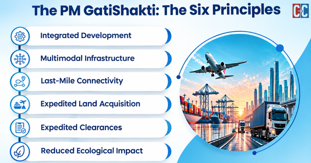
GatiShakti’s six guiding principles include expedited land acquisition, minimised clearances and reduced ecological impact, goals that can pull in different directions. Using the platform, the Pune–Bengaluru Expressway alignment was revised to cut forest-land overlap by 19 per cent, the PIB says. But when Deccan Herald reported NHAI’s estimates in July 2023, the 719-km corridor needed nearly 20,000 acres across 12 districts, including 383 acres of forest land in Karnataka, and NHAI officials expected about 25,000 trees to be felled.
Leo Saldanha, coordinator of the Environment Support Group, called it worrying that NHAI described open grasslands as barren wasteland. Activist Dattatreya Devare argued that such a project needs justification backed by expert advice and genuine stakeholder consultation, noting that the existing NH-48 is “not crowded, except near city centres.” The PIB now describes a 699-km expressway due by 2027-28, but provides no revised land or tree-loss figures.
What to watch
Institutions are being expanded. The Union Cabinet has approved the setting up of an Integrated Transport and Logistics Authority to evaluate projects exceeding ₹500 crore. The platform has been open to private users since October 2025, with 230 approved datasets to date. The background says not to include any of these layers if they incorporate resettlement, livelihood, or compensation data.
Year five of Gati Shakti offers potential for increased cartographic precision. The ability to measure the communities covered by these lines may affect measurements over the next five years.
Clear Cut Research Desk
New Delhi, UPDATED: October 16, 2026 19:10 IST
Written By: Yatharth Pathak