

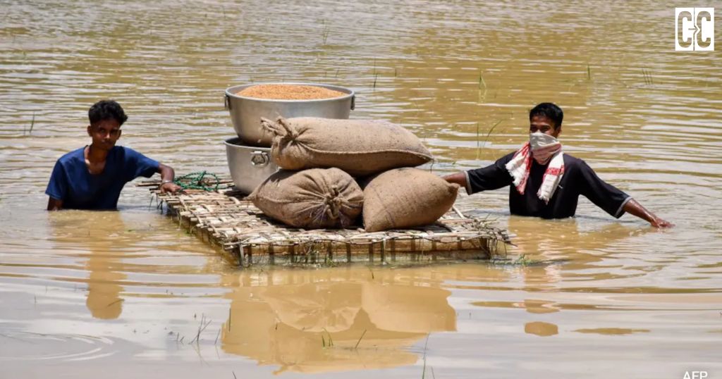
- The 2026 Assam floods affected over 10 lakh people and claimed more than 70 lives, exposing the state’s continued vulnerability due to heavy upstream rainfall, river sedimentation, and repeated embankment failures.
- Experts argue that relying only on embankments is ineffective, calling for scientific silt management, wetland conservation, improved flood forecasting, and climate-adaptive infrastructure to reduce future flood risks.
The 2026 monsoon has so far claimed over 70 lives and impacted more than 10 lakh residents in the state of Assam, while the toll continues to rise as relief efforts get underway in the cut-off villages of Upper Assam. This year was a little bit unexpected, not because the Brahmaputra overfilled its banks, but because of rainfall in the uplands of Nagaland and Arunachal Pradesh, which led to higher flows in the Dikhow and Disang, hence the floods in the districts of Sivasagar, Charaideo, and Jorhat. But the vulnerability isn’t new: About 40 percent of the land in Assam is part of the Brahmaputra floodplains – a proportion nearly four times higher than the national average – and the state has experienced devastating floods nearly once every decade since the 1970s, according to the Assam State Disaster Management Authority.
Geography plays a larger part. The huge quantity of Himalayan sediment flows down by the Brahmaputra falls to the riverbed where the riverbed slope decreases over the Assam plains and gradually reduces its storage, displacing water onto floodplains; climatic variability sharpens this process – the India Meteorological Department stated there wasn’t one single cloudburst, but instead extended periods of intense rainfall over upstream catchments.
The state’s main defence for more than seven decades has been structural. The total length of the state’s embankment is almost 5,000 kilometres today, a structure constructed under the Assam Embankment and Drainage Act, 1953. The Assam State Disaster Management Authority has developed a flood forecast alert and a map of the river course, along with floodplain zoning, for the state. At the same time, the World Bank has approved a $108 million fund for flood forecasting and resilient housing facilities, along with an Asian Development Bank-assisted project to manage the risk of river erosion.
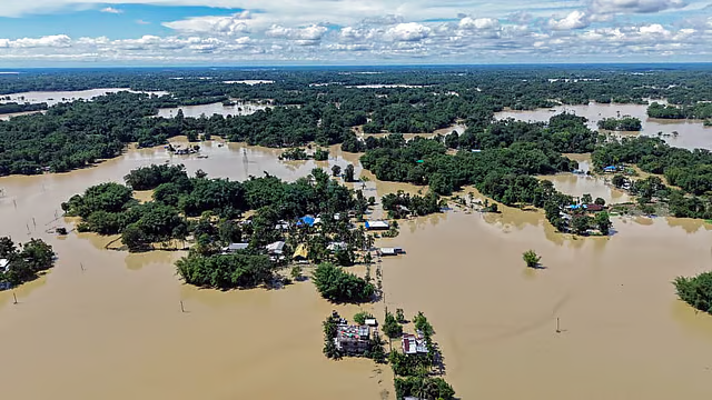
Yet the gap is hard to miss. A total of 18 embankments breached, and another 25 were damaged in Assam, between April 29 and July 6 of this year alone, preceding the highest intensity of the monsoons. As six more failed in Jorhat district after July 17. With total spending on embankment development and protection at 1,500 crores over three years (between 2021 and 2024), there has been little effect on moderating water levels: a government probe of data and reports indicates.
Sociologist at Ashoka University, Mitul Baruah, a resident expert in the Brahmaputra valley who has researched the area for more than ten years, has called embankment projects a “mistake” and “neither a solution nor part of the solution”, believing they trap a river’s destructive force and lead to encroachments in floodplains, inevitably to be overwhelmed.
In the past, the Verma Committee, set up by the government itself, was formed to look into effective management, including systematic pre-monsoon embankment maintenance and patrolling protocols, most of which remain unimplemented.
The burden falls unevenly. Communities on char-chapori river islands — largely landless, and disproportionately Muslim and tribal households — face repeated displacement and erosion; a study of Kamrup district’s chars found female literacy and land ownership among the lowest in the state, alongside chronic seasonal migration for work. Research in the Economic and Political Weekly has traced how flood displacement intersects with Assam’s citizenship politics, compounding precarity for marginalized residents both inside and outside relief camps.
Assam’s predicament is not unique. Bihar’s Kosi embankments, built after 1955, trapped villages between the walls and are estimated to have helped expand the state’s flood-prone area from 2.5 million to 6.8 million hectares — prompting a shift toward the World Bank-backed Kosi Basin Development Project, which pairs embankment repair with simulation-based forecasting. The Netherlands took a different route after near-catastrophic floods in the 1990s: its “Room for the River” program deliberately widened floodplains and relocated some communities rather than raising further, a move now widely studied as a model for sustainable flood management. Bangladesh has leaned on people rather than concrete, training community volunteers under local Union Disaster Management Committees to relay flood warnings door-to-door in areas outside formal gauge networks. Across the Brahmaputra valley, scientists involved in its study are increasingly advocating for such an adjustment in Assam: scientific silt management, Wetland conservation, and climate-adaptive infrastructure design, supported by an examination of embankments pre-monsoon not post-breach, when the catastrophe is already an irreversible, destructive fact. As things stand, it will be the most vulnerable, poorest Assamese – the ones who are the least able to reconstruct their shattered lives- who will continue paying the price of a disaster the state has not yet begun to live with.
Clear Cut Climate Desk
New Delhi, UPDATED: July 31, 2026 09:00 IST
Written By: Yatharth Pathak